- July, 2004. Atlantis Scientific will be exhibiting with Vexcel Corporation at ISPRS 2004 in Istanbul, July 19-23, 2004.
Come see the latest in SAR remote sensing technology - EarthView� InSAR Coherent Target Monitoring (CTM) � a unique software tool to detect sub-centimetre land motion over extended periods of time.
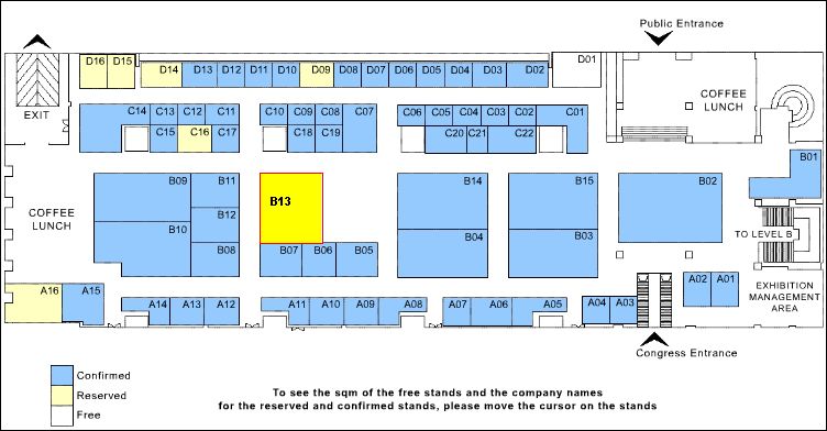
The Vexcel exhibit is at location B13 in the main level exhibit area. See you there!
To see the full image, click on it.
- February, 2004. Atlantis Maps the North - Atlantis Scientific has been awarded a contract from Natural Resources Canada, Centre for Topographic Information (CTIS) to produce high resolution elevation data for Devon Island, Nunavut Territory. You can read the full press release here
- December, 2003. Atlantis-Scientific wins European Space Agency (ESA) Wetlands Management Contract.
You can download a copy of the English press release in PDF format here.
You can download a copy of the French press release in PDF format here.
- December, 2003. Atlantis Scientific Inc., is please to announce a new addition to our
staff. Kevin Jones (Project Manager, GlobWetland).
- October, 2003. Atlantis Scientific Inc., is please to announce two new additions to our
staff. Bob Dams (Business Development Manager, EOServ) and Bobby Clarke (Controller).
- September, 2003. Atlantis Scientific Inc., is please to announce two new additions to our
staff. Tod Lewis and James Ikkers.
- June, 2003. Atlantis Scientific Inc.,has been awarded $325,000 by the Canadian Space Agency,
under the Earth Observation Application Development Program, to develop finishing tools for radar-derived digital
elevation models.
You can read the full press release here
- June, 2003. Atlantis Scientific Inc. from Nepean, Ontario, has been awarded $236,843
by the Canadian Space Agency, under the Earth Observation Application Development Program, to monitor infrastructure
in Urban Areas Associated with Petroleum Production.
You can read the full press release here
- April, 2003. Indian Institute of Technology Roorkee Purchases EarthView� InSAR and APP
Click on the above link to read the article in PDF format. 
- September, 2002. "4D from the Heavens" from New Technology Magazine, September 2002
Click on the above link to read the article in PDF format.
- April 22, 2002. "Star Wars Technology help Manage Belridge Subsidence"
This is a publication in the internal Newsletter Aeragram of Aera Energy which describes the success of InSAR monitoring of the Belridge Oil Field, Issue 24, April, 2002.
- April 10, 2002. Atlantis Scientific Inc. (ASI) announces the release of a new EarthView� SAR processing product, EarthView� Stereo. The addition of this product is a major enhancement to Atlantis Scientific's product line, allowing Atlantis to offer its clients a more complete set of tools to generate higher-level radar data products including digital elevation models.
The full press release can be found here.
- January, 2002. Atlantis Scientific Inc. announces unveiling of new ENVISAT module
Support for ESA's next generation radar satellite, ENVISAT, is now available in EarthView� APP PRO for all beam image mode processing and is under development for EarthView� InSAR PRO. The OpenEV viewing tool kit also supports Envisat official file format standards.
Work has just been completed to add an ENVISAT ScanSAR capability for EarthView� APP PRO, which will support not only ENVISAT's wide swath mode, but also its alternating polarization mode. The processor is capable of reading, writing and displaying the new ESA data file formats, which are no longer going to be provided in CEOS format.
An ENVISAT module for EarthView� InSAR PRO is scheduled for release in the second quarter of 2002.
ASI is a world leader in the field of radar remote sensing. ASI has a strong heritage in developing leading-edge solutions, creating powerful and robust software tools for advanced remote sensing applications. The company's cost-effective products not only include the EarthView� APP PRO; a SAR processor for transforming raw radar data into custom processed imagery, but also the EarthView� InSAR PRO; a system used for scientific and operational exploitation of SAR interferometry. ASI has widespread experience with operational projects including the production of digital elevation models (DEMs) and differential interferograms used for change detection analysis.
For product information please contact James Ikkers
- June 15, 2001. The May 2001 isue of the AAPG (American Association for Petroleum Geologists) Bulletin contains the following publication:
The use of Satellite-based radar interferometry to monitor production activity at the cold lake heavy oil field, Alberta Canada, AAPG Bulletin, V. 85, No 5 (May 2001), pp. 781-793. The authors of the article are Stan Stancliffe (Imperial Oil Resources) and Marco van der Kooij (Atlantis Scientific Inc.). It is another example of a proven technology that is applied world-wide for the monitoring of oil reservoirs.
A digital .pdf file of the article can be accessed here.
|